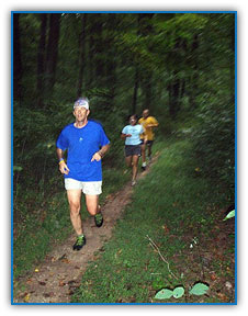
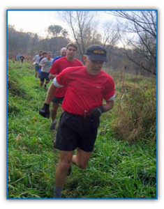
LRRC & TrailsLancaster County and the surrounding area is fortunate to have a wonderful network of trails to provide runners with the opportunity to find a new challenge, vary their training schedule and enjoy the great outdoors. Local trails range from the flat and smooth surface of a recreation trail to the rocky and gnarly challenge of a hilly hiking trail. Runners use trails for a variety of reasons. For example, some runners enjoy trails for the forgiving surface on an easy recovery run, while others focus on trails in their training and compete in trail races. The purpose of this page is to provide an easy to follow guide to the trails of the Lancaster County area broken out in terms of Easy, Moderate and Advanced trails. Our goal is that you will find a trail that fits your specific training needs.
Easy TrailsTrails in this category are generally flat and have a smooth surface. These trails are ideal for a person who has never run on a trail. These trails are also perfect for fartlek training, or for an easy recovery run after a track workout or a race. Lancaster Junction Recreation TrailLocation: The trail can be accessed on Auction Road near Manheim, or just off the Salunga Exit of Route 283 on Champ Road. Details: The trail is 2.5 miles in length and runs along an old industrial railroad bed. The surface, comprised mostly of cinders, is flat and forgiving. Mile markers are posted along the trail. The trail is maintained by the County of Lancaster Parks Department. For more information, contact the Parks Department. Conewago Recreation TrailLocation: The trail can be accessed on Route 743 approximately .5 miles North of Route 283, or on Route 230 one mile West of the Borough of Elizabethtown. Details: The trail is 3 miles in length. Its surface is flat and forgiving, and mile markers can be found along the trail. The trail is maintained by the County of Lancaster Parks Department.
Moderate TrailsTrails in this category generally have a smooth and forgiving surface, however, they may also include some hills, rocks and uneven sections. These trails provide an excellent opportunity to learn the skills to become a trail runner. In addition, while these trails are excellent for easy or recovery runs, they are often the venue for hotly contested races. Lancaster County Central ParkLocation: The main entrance to the Park is on Chesapeake Street between South Duke Street and South Queen Street in Lancaster City. Details: Lancaster County Central Park is probably the most convenient source of moderate trails in the Lancaster area. The park's trail network can probably accommodate runs of up to 10-12 miles. The trails are mostly very smooth and forgiving with many rolling hills. The LRRC meets at the park almost every Sunday morning at 7:30 a.m. Running with the club at this time is the easiest way to learn your way around the trails. However, the County of Lancaster Parks Department maintains an easy to read map of the park's trails. For more information, contact the Parks Department at (717) 299-8215 or see the park website. Races: The LRRC sponsors two races in Lancaster County Central Park. On Fathers' Day in June, men and women can compete in the Smith's Challenge Trail race. Mount Gretna TrailsLocation: Trails can be accessed from many places in the Mount Gretna area, however, the best place to access the trails is by parking at one of the many parking areas located along Pinch Road. Pinch Road is a left hand turn when traveling North on Route 72 about 4 miles North of the Borough of Manheim. Details: The trails in Mount Gretna provide a wonderful resource for the budding trail enthusiast. The trails in this area lie on a combination of State owned Game Lands and "protected natural property" owned by the County of Lebanon. One can run any distance from 1 to 15 miles without running on the same trails twice. In fact many trail runners utilize Mount Gretna for 2-3 hour long runs. The terrain is relatively easy with a few hilly and rocky sections. The beginner will be challenged, but the expert will not be disappointed. The entire Mount Gretna area is beautiful, and contains much History. After your workout, a trip to town is very worthwhile. The town has several restaurants, a swimming lake, a playhouse and a famous ice cream joint called "The Jigger Shop". Races: While there currently are no official races on Mount Gretna Trails, the LRRC holds an informal triathlon in the area every August. Also club members can often be found on the trails on Thursday evenings during the Summer months.
Advanced TrailsTrails in this category are for the true trail rat. They contain lots of uneven terrain, rocks, roots, steep hills, trees, cliffs, water and other objective hazards. A novice could certainly have fun on these trails, however, it would probably be best to cut your teeth on some moderate trails before hitting the following areas. The rewards for venturing onto these trails are amazing. For example, you will see breathtaking views, beautiful flora and fauna, wildlife, and best of all, you will find some solitude. Advanced trails will also build fitness, strength, coordination and balance. Advanced trails are also the home to some of the most challenging races one can enter. The big ones. The county offers the Conestoga Trail System and the Horseshoe trails. The Mason Dixon trail runs north south through York County. The Appalachian and Tuscarora trails can be accessed in a little more than an hour from Lancaster. Conestoga TrailLocation: The Conestoga Trail can be accessed at several points along River Road in Southern Lancaster County. The most popular trailheads are at Pequea Creek Campground, Tuquan Glen, Pinnacle Overlook and Holtwood Park. To reach these locations simply follow Route 324 South to River Road and look for the brown signs which direct you to these locations. The area is owned by PP&L, and the trail is maintained by the Lancaster Hiking Club. Please respect the area and leave no trace that you were there. Details: The Conestoga Trail is a rugged trail that runs along the Susquehanna River from Pequea Creek Campground to Lock 12 in Southern York County. It is easy to follow with salmon colored blazes on trees. The trail is strenuous but extremely beautiful. When running on the trails, you will ascend and descend many steep hills, and go through small streams that run into the river. You will get countless views of the Susquehanna River from the tops if hillsides and cliffs. You are likely to see buzzards, eagles, deer, turtles, foxes, snakes and polecats. You will also pass through Tuquan Glen Conservancy Area. This place is so beautiful that it will surely become one of your favorite spots in the County. The Conestoga is an excellent choice for a weekend jaunt through some real woods or a serious long training run in preparation for your next marathon. Races: The popular Conestoga Trail Run 10 miler is held here each September. The is a very challenging race for the expert trail runner. It is also a club event, so if trails are not your thing, or youre not ready for a race of this caliber, come out and volunteer--you will see some amazing performances. The Mason Dixon TrailLocation: The trail can easiest be reached by taking route 372 West over the Norman Wood Bridge into York County. Immediately after crossing the bridge, turn right into the Lock 12 Parking area, and the trailhead is on your right. The trail lies on property owned by PP&L and the Gladfelter Pulp Wood Company. Details: What the Conestoga Trail is for the Lancaster County side of the Susquehanna River, the Mason Dixon Trail is for the York County side. The best running on the trail starts at Lock 12 and goes north along the Susquehanna River following blue blazes on trees and rocks. The Mason Dixon Trail is very similar to the Conestoga Trail in terms of terrain. It is a very beautiful place to get away from people and run alone. Although, the most popular run on the Mason Dixon Trail is an out and back from Lock 12, other training possibilities exist and will be added in future updates. Trails
Links of interest |


